Flood risk is something that should always be considered when buying a home, but the information is sometimes difficult to look up. And it will determine whether your lender will require flood insurance, what that costs every year for as long as you own the place, and what happens in the worst case weather scenario.
The good news is that the data is public, free, and official. The bad news is that FEMA built it for floodplain managers and insurance agents, not for home buyers.
Here's how to see the flood map in Real-Helper, and how to look it up on FEMA's website.
In Real-Helper
The short version
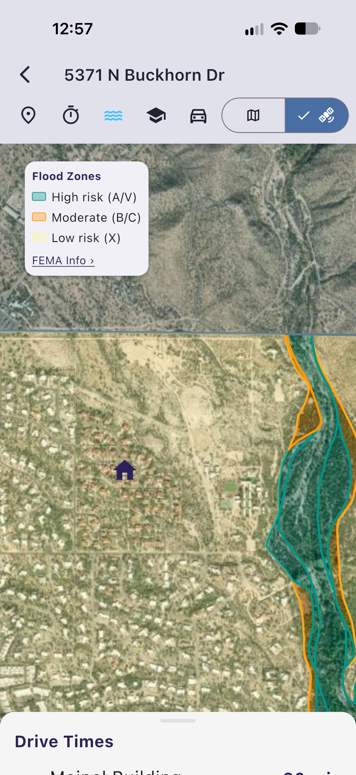
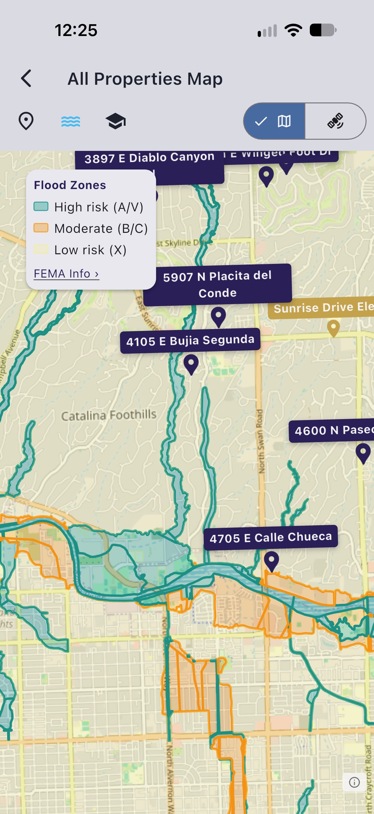
If you're house-hunting, consider downloading our iOS app (Download button upper right corner)- it can be a real time-saver, and you might find it worthwhile just for the quick flood maps. In Real-Helper, open any property, tap the map, then tap the water icon. The flood zones draw themselves over the property of interest and the streets around it, color coded by risk. No address to retype, no panel numbers, no PDF. If you access the map from the My List page, you get all the properties at once, and you can display the flood overlay there as well.
It is free, no subscription required. The rest of this page describes the "long way" to this information, through FEMA's own website. We're happy to provide these details here for those who want a deeper dive.
Where Real-Helper's flood data comes from
Straight from FEMA. No reseller, no cached copy of a copy, no third-party risk score.
The app queries FEMA's National Flood Hazard Layer, the public ArcGIS service that carries the same flood hazard geometry as the FIRMs:
hazards.fema.gov/arcgis/rest/services/public/NFHL/MapServer/28
Layer 28 is Flood Hazard Zones. For each polygon the app reads the FLD_ZONE and ZONE_SUBTY fields, which is how it can tell shaded X from unshaded X and color them differently rather than lumping all X together as "fine".
It is fetched live when you tap the water icon, so you see what FEMA is publishing that day. What the app does not do is make a determination. For anything legal, financial or final, go to the effective FIRM.
On FEMA's website
Bookmark this one link and skip the wandering
https://msc.fema.gov/portal/search drops you straight onto the address box. Everything below starts there.
We spent a good while wandering around the FEMA site before finding it, because nothing obviously points at it from the front page. You do not have to. You're welcome.
Go straight to the address search
Use this link:
https://msc.fema.gov/portal/search
That is FEMA's Flood Map Service Center, Search By Address. It opens on a single box that reads "Enter an address, place, or coordinates". Type the address, press Search, done.
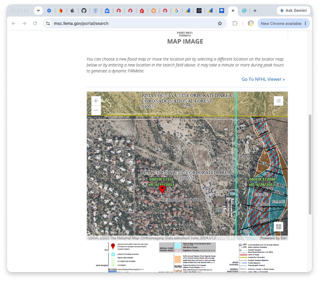
What comes back is the effective FIRM, the Flood Insurance Rate Map panel covering that spot. "Effective" means the one legally in force today, which is the one your lender and your insurer will use.
Read the FIRMette it builds for you
A full FIRM panel is about two feet by three feet printed at full scale, which is no use on a laptop. So FEMA gives you a FIRMette instead: in their words, "a full-scale section of a FIRM that you create yourself and is formatted to print on most home/office printers."
The good news is that the search results page generates a dynamic FIRMette around your pin automatically. It warns that this can take a minute or more at busy times, so give it a moment before deciding it is broken. Preliminary maps cannot be turned into a FIRMette at all.
Switch to the NFHL Viewer if you want to pan around
A static panel is awkward if the property sits near a zone boundary and you want to see which side of the line it falls on. There is a Go To NFHL Viewer link on that same results page, which opens FEMA's interactive National Flood Hazard Layer map, with its own print tool.
You can also move the pin or enter a new location from the results page without starting over.
Check whether the map is about to change
This step gets skipped and it matters. The effective map is not always the latest word: FEMA issues preliminary maps before they take effect, and a property can be sitting in a zone that is about to be redrawn.
Use Search All Products on the Map Service Center for historic, pending and preliminary maps, or the Flood Map Changes Viewer at msc.fema.gov/fmcv to compare what is effective now against what is coming.
What the FEMA flood zone letters mean
The letters are the whole point of the map, and they are not obvious. Here is what FEMA means by each group. The colors are the ones Real-Helper uses on its own map.
| Zone | Risk | What FEMA means by it |
|---|---|---|
| A, AE, AO, AH, A99, AR, A1-A30 |
High Special Flood Hazard Area |
Land that will be inundated by a flood having a 1 percent chance of being equaled or exceeded in any given year. FEMA also calls this the base flood, or the "100-year flood". |
| V, VE, V1-V30 | High Special Flood Hazard Area |
The coastal members of the same 1 percent group. If you are looking inland you will not meet these. |
| X (shaded) older maps: B |
Moderate | The ground between the edge of the base flood and the 0.2 percent annual chance flood, which you will see called the 500-year flood. Outside the SFHA, but not nothing. |
| X (unshaded) older maps: C |
Minimal | Outside the Special Flood Hazard Area and higher than the 0.2 percent annual chance flood level. |
"100-year flood" does not mean once a century
It is the single most misleading phrase in this whole subject. It means a 1 percent chance in any given year, every year, independently. Over a 30-year mortgage that works out to roughly a 1 in 4 chance of being flooded at least once. Two "100-year floods" in consecutive years is not a freak event or evidence the map is wrong. It is just how probability works.
Both have their place
Use Real-Helper's water icon for a quick check on any property. If that quick check raises concerns, follow up with the Map Service Center. And be sure to ask your insurance agent once you've decided on a house.
Check the flood risk on every house you are considering
The flood zone overlay is free, for up to five properties, along with school district boundaries, drive times and isochrone zones. Start without signing in.
Download Free on the App StoreWhen flood insurance is actually required
TL;DR: floodsmart.gov is what you want.
Three things have to be true at once. Under the Flood Disaster Protection Act of 1973 and the National Flood Insurance Reform Act of 1994, your lender must require flood insurance when:
- the building sits in a Special Flood Hazard Area (any of the A or V zones above), and
- the community takes part in the National Flood Insurance Program, and
- your lender is a federally regulated, supervised or insured institution, or a federal agency lender. In practice that is nearly every mortgage.
Outside an SFHA nobody forces you to buy it, and plenty of people in shaded X zones do anyway, because a 0.2 percent annual chance is not zero and the premiums outside the high-risk zones are a great deal cheaper.
The 30-day rule you should know about
An NFIP policy can take up to 30 days to come into effect. If you are closing in three weeks on a house in an A zone, that is a problem you want to discover now rather than the week before. Ask about it early.
Finding a policy
Flood insurance under the NFIP is administered by FEMA but sold and serviced by a network of around fifty private insurance companies, plus NFIP Direct. The official place to find one is the provider finder at floodsmart.gov, which lists providers by state. You can also call the NFIP on (877) 336-2627.
Often the simplest route is to ask whoever is writing your homeowner's policy, since the same agents frequently sell NFIP policies too.
Real-Helper is an organizer. It is not affiliated with, endorsed by, or a partner of FEMA, the National Flood Insurance Program, or any insurer, real estate listing site, brokerage, or multiple listing service. Flood zone information in the app and on this page is for general information only and is not intended for legal, engineering, insurance or surveying use, and it is not a flood hazard determination. Official determinations must be made using the effective Flood Insurance Rate Maps published by FEMA. Flood maps are revised, so check the Map Service Center for preliminary and pending changes before relying on any zone. Insurance requirements and waiting periods described here are general and your lender and insurer decide what applies to you. Descriptions of FEMA's tools reflect their published guidance as of November 2026.