You have six houses on your short list. Which one puts you closest to work and still within reach of your mother's place? Which ones are in the same school district? Does any of them sit in a flood zone? These are map questions, and they are pivotal in any house-hunting decision.
Now try answering them. Google Maps will give you one route at a time, so six houses and four destinations is twenty-four lookups and a notepad. Zillow will filter listings by commute to a single address, which is a fine way to narrow a search but no help at all once you have already picked your six. For the flood map you go to FEMA. For school boundaries you go hunting, and good luck.
Real-Helper puts all of it on one map, because that is the job it was built for.
Four things our map does
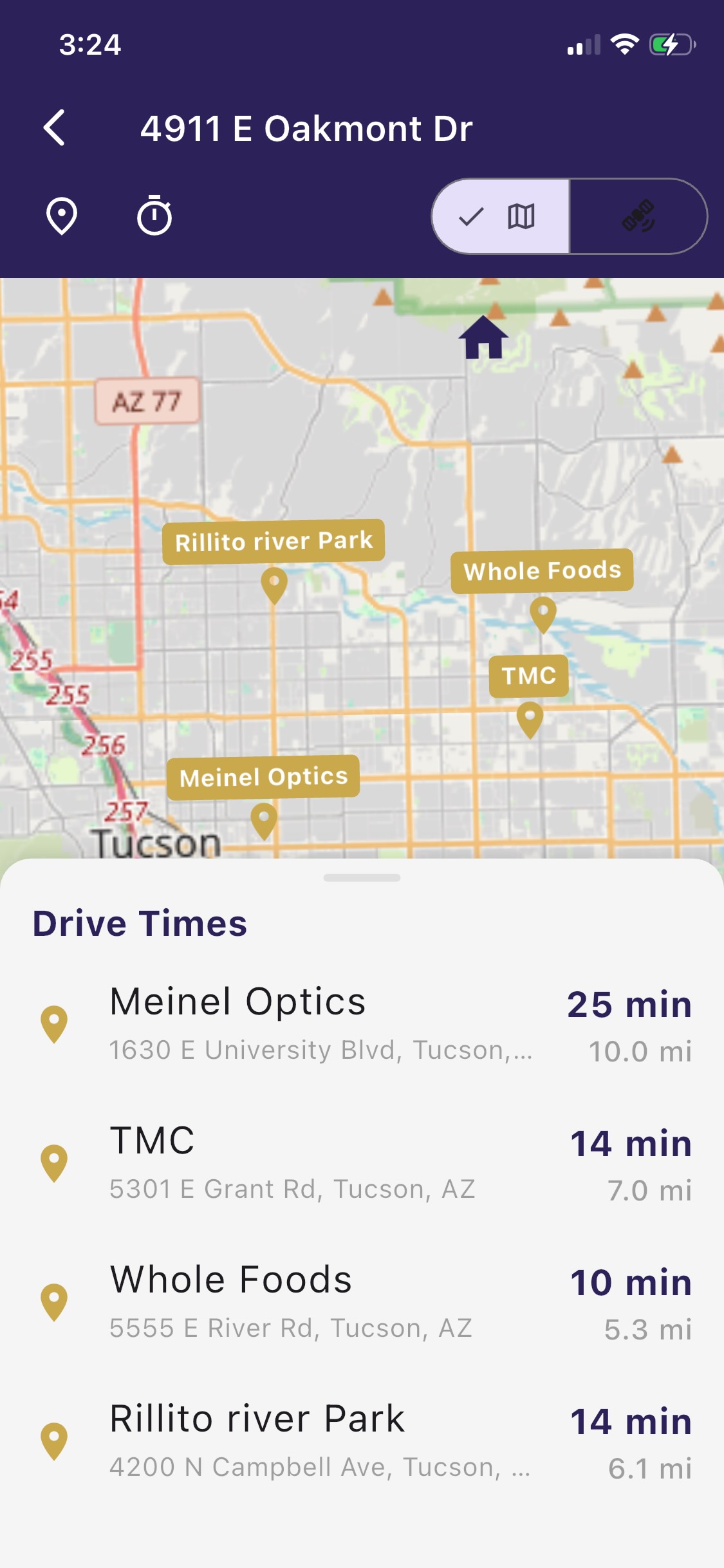
Your own points of interest, and drive times to every one of them
Save the places you actually go. Work. School. The gym. Your mother's house. The trailhead. They show up as gold pins next to your properties, and on any property's map a sheet slides up listing the drive time and distance to every single one of them, side by side.
Not one route. All of them, for that house, in one list. Then open the next house and read the same list again. That is the comparison you have been trying to do in your head.
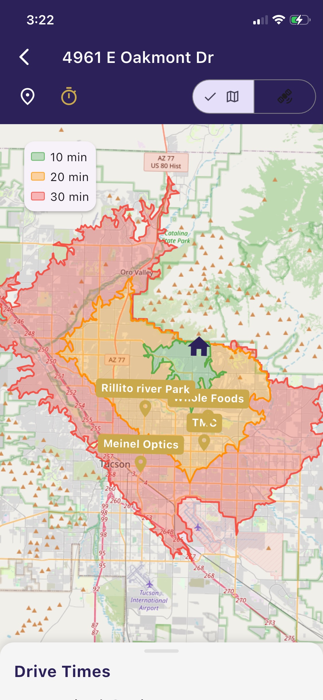
Isochrone zones: everywhere you can reach in 10, 20 and 30 minutes
Tap the stopwatch and colored bands spread out from the house showing how far you can actually drive in ten, twenty and thirty minutes. Not a circle drawn with a compass. The real shape, following the real roads, which around a mountain or a highway interchange looks nothing like a circle.
It answers the question you cannot ask any other way: not "how far is this house from one place" but "what is within reach of this house at all?" Turn on satellite view at the same time and you can read the neighborhood while you do it.
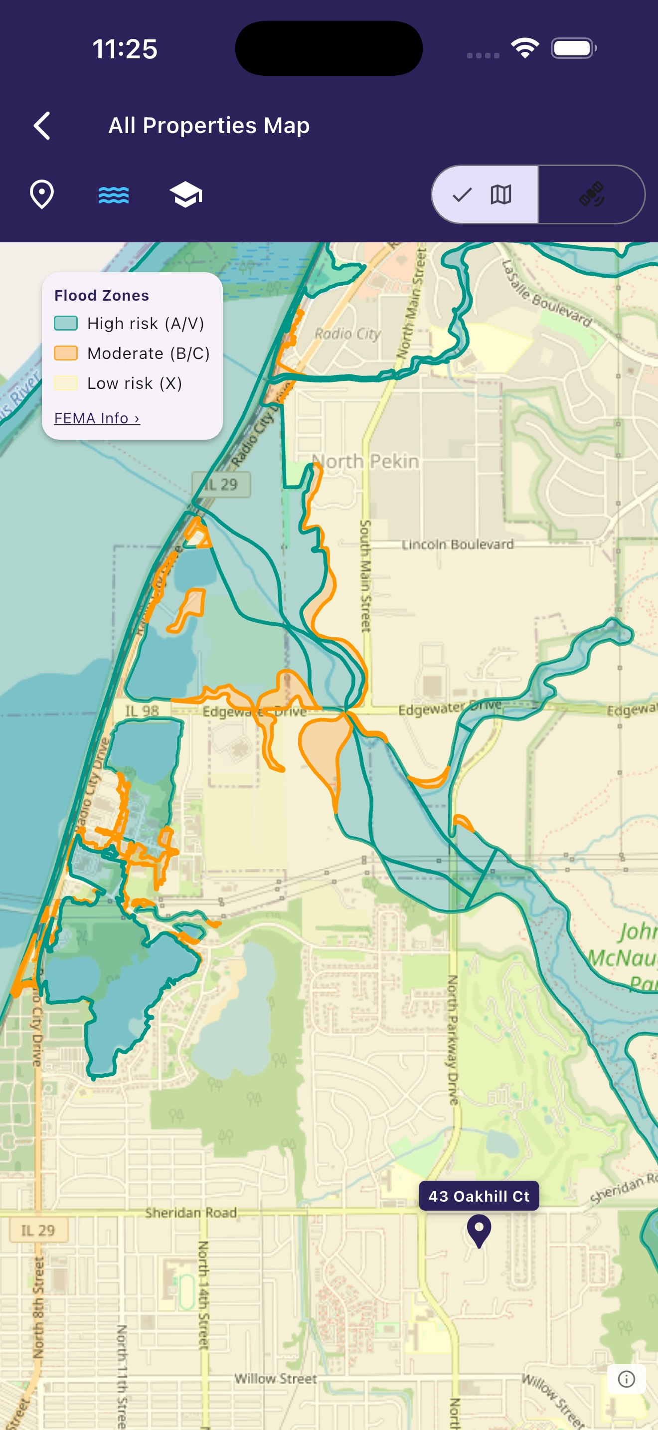
FEMA flood zones, without the scavenger hunt
Tap the water icon. The flood zones draw themselves on the map, color coded: teal for the high risk Special Flood Hazard Areas where a federally backed mortgage will typically require flood insurance, orange for moderate, yellow for minimal.
The alternative is to go to the FEMA Flood Map Service Center and look up each property of interest.
To read more about flood maps, see our article on Flood Zone Lookup.
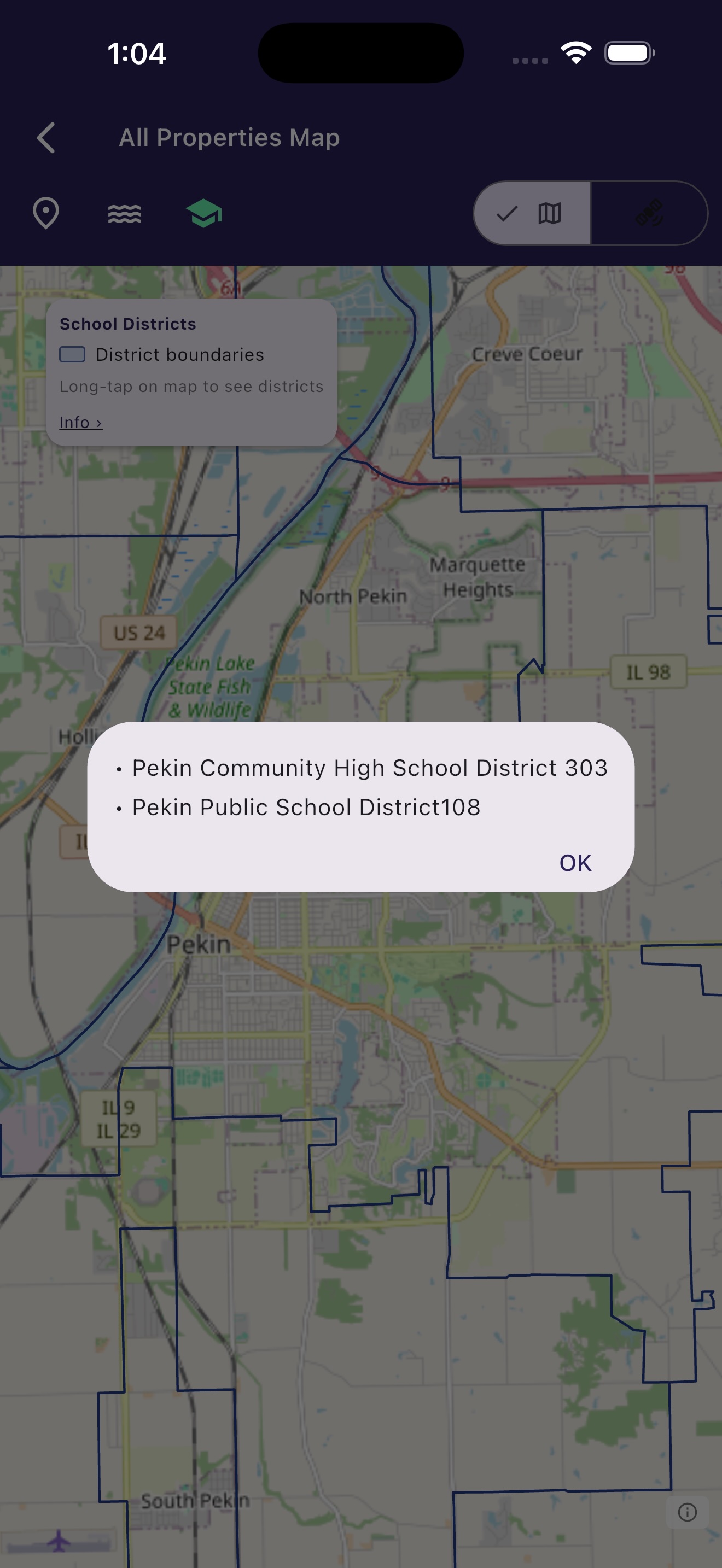
School district boundaries, drawn on the map
Tap the school icon and the district lines appear. Tap anywhere inside them and you are told which district that spot belongs to.
This matters more than people expect, because district boundaries do not follow city limits or zip codes. Two houses on the same block can land in different districts.
Side by side
Four map tools, and what each one is actually for.
| Real-Helper | Zillow map | Google / Apple Maps | |
|---|---|---|---|
| Browse homes for sale | No | Yes, that is the point | No |
| Your short list on one map | Yes | Saved Homes | Saved lists |
| Save your own destinations | My Places | No | Yes, starred places |
| Drive time to one destination | Yes | Commute filter, one address | Yes, one route at a time |
| Every house to every destination, in one list | Yes | No | No |
| Isochrone travel-time zones | Yes, 10 / 20 / 30 min | No | No |
| FEMA flood zones | One tap | No | No |
| School district boundaries | Drawn on the map | Assigned schools per home | No |
| Satellite view | Yes | Yes | Yes |
| Turn-by-turn navigation | Hands off to your maps app v1.1.2 | No | Yes, and nobody should try to beat them at it |
"I need to drive there. What now?"
Real-Helper does not do turn-by-turn navigation, and it should not. Apple and Google have spent twenty years and a great deal of money on that problem, and they have won it. What Real-Helper can do is hand the house over to whichever of them you drive with.
Coming in version 1.1.2: a car icon on the property map. Tap it and you are asked once which app you prefer, from the ones actually installed on your phone: Apple Maps, Google Maps or Waze. After that the car icon opens a single button, Directions in Google Maps or whichever you chose, with a quiet "Change mapping app" underneath if you ever want to switch. No settings screen to go hunting through.
It hands over the coordinates rather than the text of the address, so the other app does not have to guess where you meant and cannot land you on the same street name in the wrong town.
The same release lets you press and hold the address at the top of the property page to select and copy it, for the times you would rather paste it somewhere yourself.
Until then, there is a shortcut that works today. Tap the + next to Links on the property page. The built-in browser opens already searching for that address, and a map of it is usually sitting right there at the top of the results. No typing, no copying.
Either way, come back to Real-Helper afterwards for the photos and the notes, which is the part the other two cannot help you with.
Both at once
None of this is an argument for closing Google Maps. Use it to drive. Use Zillow to find what is for sale. Then bring the handful of houses you are serious about into Real-Helper, where you can lay them against the places in your life and see which one actually fits.
Put your short list on a map that answers your questions
My Places, drive times, isochrone zones, flood maps and school districts are all in the free version, for up to five properties. Start without signing in.
Download Free on the App StoreReal-Helper is an organizer. It is not affiliated with, endorsed by, or a partner of Zillow, Google, Apple, FEMA, or any real estate listing site, brokerage, or multiple listing service. Flood zone data is shown for information only and is not for legal, engineering or surveying use; official flood hazard determinations should be made using the effective Flood Insurance Rate Maps published by FEMA. School district boundaries can change, so confirm with the district before you rely on one. Drive times are estimates. Comparisons with other map tools reflect what we saw using them in November 2026, and any of them may change what it offers at any time.