Which school district is this address in?
Enter a US street address with the city and state, or the ZIP code.
Your browser sends the address to the US Census Bureau to find it on the map, then checks that spot against public school district boundaries. Real-Helper never receives or stores it.
School district boundaries don't follow city limits or ZIP codes. Two houses on the same street can be in different districts, and a "Springfield" mailing address can sit in a district named after a different town entirely. Listings often get it wrong, or leave it out.
The district is not the same as the assigned school
The lookup tells you which district serves the address. Inside a district, each school has its own attendance zone, and those zones are drawn by the district, change more often, and are not in any national dataset.
To find the specific school a child would attend:
- Look on the district's website for a "school locator", "boundary finder" or "find my school" page. Most larger districts have one.
- If there isn't one, the district's enrollment or registration office can confirm it from the address.
- Ask whether the zone is under review. Districts redraw attendance zones when schools open, close or fill up, sometimes with little notice.
Some states also allow open enrollment between districts, and charter and magnet schools take students from outside their area. The district still matters for those: it decides your default school, and the local school taxes you pay.
Why you might see two districts
In much of the country one unified district runs every grade. But in some states, an elementary district and a separate high school district cover the same ground. In those places the lookup shows both, because a family with children of different ages deals with both.
Where the boundaries come from
The US Census Bureau publishes school district boundaries every year, collected from state education agencies and distributed by the National Center for Education Statistics (NCES). The lookup shows which school year the data describes. Boundaries change by consolidation, annexation and new construction, so a recent change may not be in it yet.
Comparing districts across several houses
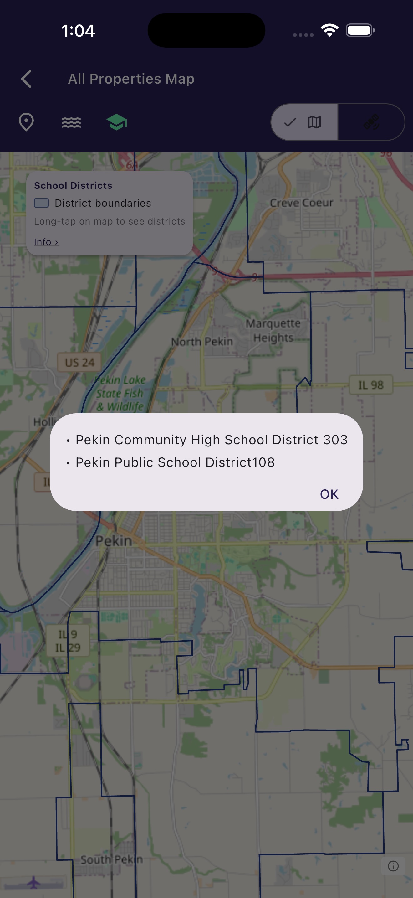
One address at a time is fine for a quick check. If you have a short list of houses, Real-Helper draws the district boundaries over the map with every property on it, so you can see at a glance which houses share a district and which ones sit just across a line.
It also records the district on each property, with the date it was checked, and puts it in the spreadsheet when you export your list.
See the school district for every house on your list
The school district overlay is free, for up to five properties, along with FEMA flood zones and drive times. Start without signing in.
Download Free on the App StoreFlood zone lookup · Mortgage calculator · More about the map features
Real-Helper is an organizer. It is not affiliated with, endorsed by, or a partner of the US Census Bureau, NCES, any school district, real estate listing site, brokerage, or multiple listing service. School district information in the app and on this page comes from public boundary data and is for general information only. Boundaries change, the data may lag behind those changes, and an address can be matched to a slightly different spot on the map, particularly near a boundary or on a large lot. A school district is not a school assignment. Always confirm the district and the assigned school with the school district directly before relying on it, and before you make an offer.